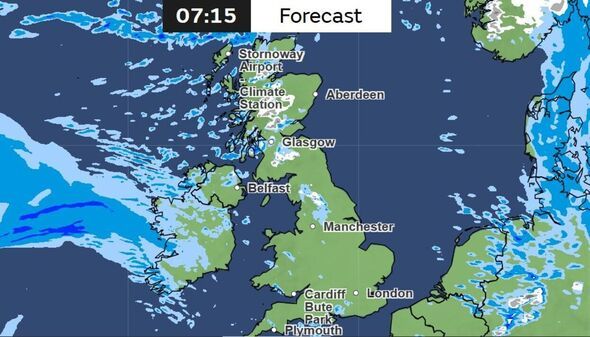
Britons in several parts of the country are being warned to wrap up as the Met Office has named the regions set to be hit by snow within hours. The UK has been battered by heavy rain and ferocious winds this week, but now temperatures are set to tumble as a low-pressure system moves in from the north-west.
National weather experts have signalled that a band of rain pushing in from the west will collide with Arctic air, triggering a wintry blast before Monday morning (March 16). The Met Office has warned that while many will see "blustery showers," those in the north and on higher ground will face the greatest hazards. Maps reveal that some areas could see temperatures drop to a bitter -2C overnight. Forecasters say the worst-affected areas will be in the north of the country, particularly on higher ground.
Met Office forecaster Annie Shuttleworth said: "We've got showers pushing in across more northwestern areas throughout the day, they won't be as frequent as they were yesterday but they still bring a risk of snow above around 400m.
"From the west that wet and windy weather does spread bringing a lot of cloud across much of western parts of the UK into Wales and across the Midlands as well. In the far east we could see a touch of frost on Sunday morning but I think that milder cloudier weather will push in so that frost risk won't last all that long into Sunday morning."
The sudden chill comes just a week after parts of England enjoyed spring sunshine and temperatures reaching 19C. Experts have said the recent shift has been caused by a cold plunge over North America supercharging the jet stream, drawing down cold Arctic air across the Atlantic.
According to the latest Met Office forecasts and weather maps, the following regions are most likely to see snow, primarily on high ground.
The Met Office forecast for Saturday evening and tonight reads in the Scottish Highlands: "Showers dying out with clear spells and a frost developing in east. Cloud increasing from west with outbreaks of rain, preceded by hill snow, spreading east overnight. Strengthening southerly winds. Minimum temperature -1°C."
Sunday's forecast reads: "Cloudy with occasionally heavy rain clearing east soon after dawn followed by sunny spells and heavy, perhaps thundery, showers, with hill snow. Strong southerly winds, with coastal gales, veering southwesterly. Maximum temperature 8°C."
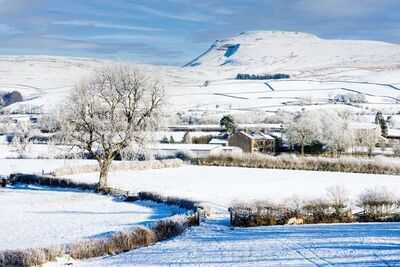
Meanwhile, the Sunday's forecast for the Yorkshire Dales reads: "Soon turning wet and windy. Rain will clear away southeastwards later in the afternoon, leaving squally heavy showers turning to snow over high ground. Feeling cold in the wind. Maximum temperature 11°C."
Contact to : xlf550402@gmail.com
Copyright © boyuanhulian 2020 - 2023. All Right Reserved.