Heavy overnight snow amounting to "blizzard" conditions could hit the UK overnight and into the early hours of the morning, the Met Office has warned. Snow and strong winds are set to cause chaos this Easter weekend as Storm Dave touches down in England, Scotland and Wales and the Met Office has issued a slew of weather warnings.
A more serious amber weather warning for wind is in place for the north of England from 7pm tonight until 3am on Sunday, April 5, while in Scotland a yellow weather warning for snow began at 2pm today and will remain in place until 3am on Sunday too, affecting Moray in the Grampian and the Highlands. The forecaster warned that heavy snow may cause disruption to travel and blizzard conditions.
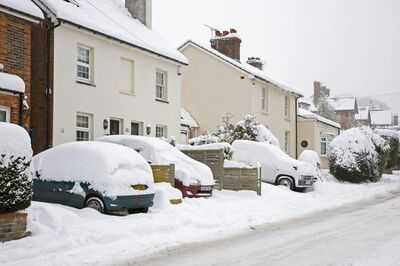
It said in its yellow weather warning for snow: "Outbreaks of snow will spread from the south during the afternoon this becoming heavy at times later in the afternoon and evening, before clearing in the early hours. 5-10cm is likely quite widely to low levels, chance of 15cm in places, with 20-30cm possible on ground above 200m. Strengthening winds will bring drifting of lying snow with the chance of blizzard conditions over the more exposed areas.
"Some areas of low ground will see rain rather than snow which may lead to minor surface water flooding in places."
The Met Office's warning for wind for England and Wales says: "A spell of very strong southwesterly, then westerly winds is expected across north Wales, northern England and southern Scotland on Saturday evening and overnight before easing early on Sunday. Gusts of 60-70 mph are possible widely with some coastal or exposed locations seeing gusts of around 80 mph."
Met Office chief meteorologist, Chris Bulmer, said: "Storm Dave will bring a period of very strong winds, with the strongest gusts most likely in the Amber warning area. People should be prepared for impacts with disruption to travel likely and possible power cuts."
"Wind speeds will peak at different times as the deep area of low pressure moves across the north of the UK, with peak gusts in Northern Ireland expected earlier on Saturday afternoon before spreading more widely across the north of the UK."
As well as strong winds, heavy snow is likely to cause disruption, with accumulations of 5-10cm possible at location over 200m in northern Scotland. Some areas could see 10-20cm and with strong wind blizzards and drifting snow will be an additional hazard. A Yellow warning for snow has been issued from 3 pm today to 3 am on Sunday covering parts of North-west Scotland.
Fortunately, the weather is set to improve into Bank Holiday Monday.
The Met Office added: "Winds will ease as Storm Dave clears into the North Sea on Sunday. Blustery showers will continue across Scotland and Northern Ireland while much of England and Wales will become fine.
"Easter Monday will be the driest day of the Easter weekend, with a ridge of high pressure in the wake of Storm Dave bringing a more settled day. Most areas will see some sunny spells after a chilly night."
Contact to : xlf550402@gmail.com
Copyright © boyuanhulian 2020 - 2023. All Right Reserved.