Advanced weather modelling maps suggest Brits could be basking in 27C heat before the end of this month.
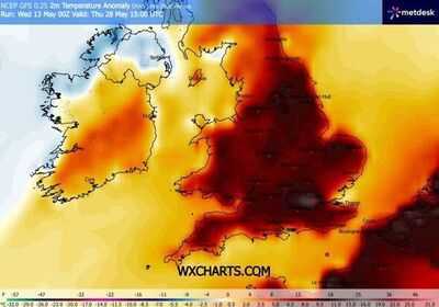
Temperature anomaly maps reveal swathes of deep red across the UK towards the end of May, particularly across England and Wales. This indicates where the mercury is forecast to climb well above the seasonal average.
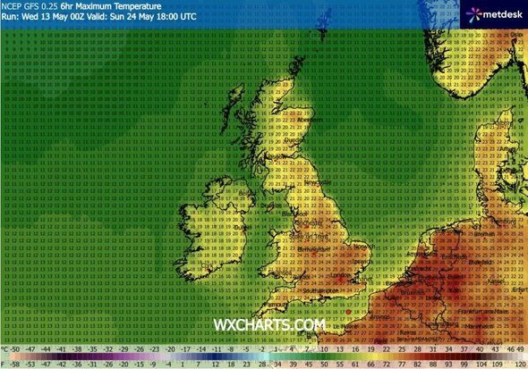
The GFS weather model suggests maximum possible temperatures could soar to 25C and beyond for five consecutive days, beginning on May 24 when data points to highs of 27C across the south-east of England.
Temperatures could reach 25C in Yorkshire on May 24, according to the data, while 23C highs are possible across parts of Wales and Scotland. Northern Ireland is expected to remain a few degrees cooler.
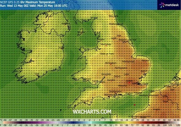
The maps again indicate 27C highs across the south-east of England on May 25, with London set to enjoy the warmest conditions. Highs of 25C are on the cards across East Anglia at around 6pm, according to the GFS mode.
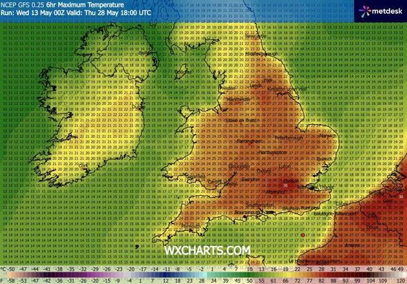
Temperatures are then forecast to ease slightly on May 26 and May 27, with highs of 25C and 26C in the south-east and 20-22C across much of England and Wales. However, May 28 could prove to be an absolute scorcher.
Overall, the GFS model indicates that as many as 20 counties could record temperatures of 27C or above across the five-day period. All of these counties are located in England.
Nottinghamshire
Lincolnshire
Leicestershire
Warwickshire
Staffordshire
Gloucestershire
Northamptonshire
Norfolk
Cambridgeshire
Oxfordshire
Bedfordshire
Buckinghamshire
Hertfordshire
Surrey
Berkshire
Sussex
Hampshire
Wiltshire
Berkshire
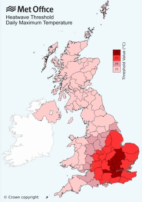
An official heatwave is declared by the Met Office when temperatures meet or exceed the heatwave threshold for three consecutive days. The heatwave threshold ranges between 25C and 28C across various parts of the UK.
It sits at 28C across the south-east of England, where temperatures tend to be considerably warmer, dropping to 25C further north. This means that even if temperatures soar to 30C on a single day, an official heatwave may not necessarily be declared.
The Met Office has suggested temperatures could turn "rather warm" towards the end of this month, yet has stopped short of confirming a heatwave is on the horizon. Its forecast for May 18 to 27 states: "Temperatures near-normal to begin, but tending to recover as the period progresses, perhaps becoming rather warm by the end of the period, especially in the south."
Contact to : xlf550402@gmail.com
Copyright © boyuanhulian 2020 - 2023. All Right Reserved.