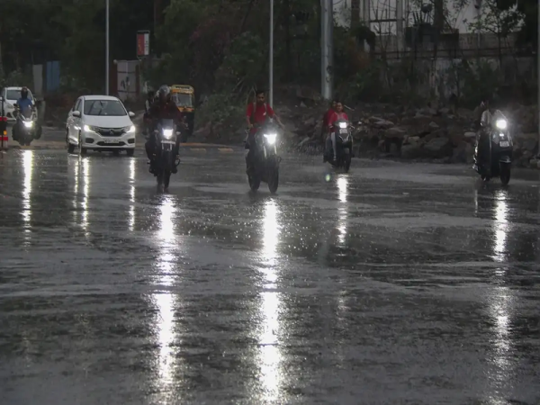
The monsoon continues to remain active across large parts of India, bringing widespread rainfall, thunderstorms and strong winds to several regions. According to the latest weather outlook, parts of northern, western, central and eastern India could experience another spell of intense weather, with heavy rain expected in multiple states.
The India Meteorological Department (IMD) has issued weather alerts for around 15 states, including Uttar Pradesh, Rajasthan, Delhi, Bihar, Haryana and Odisha. Some areas could witness heavy to very heavy rainfall, while thunderstorms accompanied by gusty winds are also possible.
With several regions already receiving significant monsoon rainfall, another intense spell could increase the possibility of waterlogging, traffic disruption and local flooding. Strong winds may also damage trees, standing crops and vulnerable structures in affected areas.
Low-Pressure System Could Intensify Rainfall
One of the major weather systems influencing the current conditions is a possible low-pressure area expected to develop over coastal West Bengal and adjoining parts of the northwest Bay of Bengal.
The system is likely to strengthen monsoon activity and bring widespread rainfall across eastern India over the next three days.
Odisha is expected to be among the states experiencing particularly intense weather. Some locations in the state may receive very heavy rainfall on August 8.
Another important weather system is developing over southwest Uttar Pradesh and neighbouring areas. A cyclonic circulation associated with a low-pressure system could influence rainfall patterns across northern India and increase the possibility of thunderstorms and intense showers.
These weather systems, combined with active monsoon conditions, are expected to keep rainfall activity elevated across several parts of the country.
Rain and Thunderstorm Warning for 15 States
Weather conditions are likely to remain unsettled across several regions. The states and Union Territories expected to experience rain, thunderstorms or gusty winds include:
- Uttar Pradesh
- Bihar
- Delhi
- Haryana
- Rajasthan
- Uttarakhand
- Punjab
- Himachal Pradesh
- Jammu and Kashmir
- Gujarat
- Madhya Pradesh
- Chhattisgarh
- Jharkhand
- West Bengal
- Odisha
The intensity and distribution of rainfall may differ from one region to another. Some places could receive short but intense spells of rain, while others may experience prolonged showers.
Thunderstorms accompanied by strong winds could also create additional risks. Trees and branches may fall during particularly intense storms, while standing crops could suffer damage in agricultural areas.
The risk may be higher in locations where the soil is already saturated following previous rounds of heavy monsoon rainfall.
Delhi Weather Today: Rain Expected on August 8
Delhi is also likely to experience another rainy day on Saturday, August 8. Moderate to heavy rainfall is possible in parts of the national capital, while winds could reach speeds of around 20 to 30 kmph.
The maximum temperature in Delhi is expected to remain close to 33 degrees Celsius, while the minimum temperature could hover around 28 degrees Celsius.
Rainfall may provide some relief from humid conditions, but intense showers could lead to temporary waterlogging in low-lying areas. Traffic movement may also slow down on roads vulnerable to flooding.
Commuters should therefore keep additional travel time in hand, particularly if heavy showers develop during peak traffic hours.
Rajasthan and Uttar Pradesh May See Active Monsoon Conditions
Rajasthan and Uttar Pradesh are also among the regions where monsoon conditions are expected to remain active.
The weather system around southwest Uttar Pradesh could contribute to additional rainfall and thunderstorm activity in parts of northern India. Depending on the movement and intensity of the system, some districts could experience locally heavy showers.
Rajasthan may similarly witness rain and thunderstorms in different areas as active monsoon conditions continue over the region.
Residents should keep track of district-level forecasts and warnings because rainfall intensity can vary considerably even between neighbouring locations.
Heavy Rain Could Increase Waterlogging and Flooding Risk
Repeated spells of monsoon rain can create problems beyond immediate rainfall. When the ground is already saturated, additional precipitation drains more slowly and can quickly accumulate in low-lying areas.
Urban locations may experience waterlogging, traffic congestion and temporary disruption to daily activities. Rural and agricultural regions could face crop damage if heavy rainfall is accompanied by strong winds or hail.
People living close to rivers, streams and other flood-prone areas should remain particularly cautious during prolonged periods of intense rainfall.
Travellers heading towards hill states should also check weather and road conditions before starting their journey, as sustained rainfall can increase the possibility of landslides, falling rocks and road blockages.
With multiple weather systems influencing different regions, monsoon activity is expected to remain significant across several parts of India. Residents in affected states should continue following official IMD forecasts and local administration advisories for the latest weather warnings.
Contact to : xlf550402@gmail.com
Copyright © boyuanhulian 2020 - 2023. All Right Reserved.